Love hiking and want to know where are the best hikes in Indonesia to experience? You’re at the right spot!
As huge fans of hiking and trekking, Indonesia has plenty of exhilarating and adventurous hiking trails to not miss. What’s not to love about spending time outdoors, getting exercise, and seeing incredible views on top of the mountains and inactive volcanoes?!
Indonesia has over 17,000 islands and there are so many hiking trails to choose from.
With the help of our travel blogging friends, we’ve narrowed down the top 12 places to go hiking in Indonesia, including day hikes and multi-day hikes. The list includes the hiking tips, hiking difficulty level, round trip distance, how to get to the trail, and the admission cost in Indonesian Rupiahs and U.S. Dollars. We want you to be fully prepared for these hikes.
Now, let’s put on hiking boots and go on many hiking adventures in Indonesia!
*Disclaimer: This post contains affiliate links. As an Amazon Associate, we earn from qualifying purchases. If you click on them and make a purchase, we receive a small commission. There is no additional cost to you. Appreciate the support.
Indonesia Hiking Tips
Before diving into the list of Indonesia’s hiking trails, hikers need to prepare for their trip. Here are some helpful hiking tips and what to bring on a future Indonesia hike.
- Bring a sturdy, lightweight backpack. Depending on the length of your hike, hikers need to have a backpack to hold the essential items. We recommend a backpack that has shoulder and hip belts so the weight of the backpack can be shifted throughout the hike. We use this backpack for all of our trips: men and women versions.
- Stay hydrated and bring a reusable water bottle. Many of the trails don’t have running water or have a convenience store, so it’s recommended to bring water. To reduce plastic usage in Indonesia, bring a reusable water bottle.
- Wear hiking boots or sturdy walking shoes. Hiking boots are necessary for hikes with uneven surfaces and dirt paths. You may need waterproof shoes if you plan a hike during the rainy season. We’ve used these hiking boots (women) for years and they’ve held up well.
- Wear proper hiking clothes and sunscreen and bring a hat. Moisture-wicking clothes will be helpful to wick away the sweat. Also, bring a hat to block off the sun. We love wearing these sun hats.
- Use hiking poles to help with stability. Some of the hiking trails will be steep so hiking poles will be helpful. Plus, they help save your knees from hiking downhill.
- Do not litter and follow the Leave No Trace principles. Let’s keep Indonesia beautiful! Always bring your trash with you to dispose of properly. Here is more information on Leave No Trace ideals.
- Don’t forget to have travel insurance! Something may happen during the hike and you may need medical attention.
Map of the Incredible Hikes in Indonesia

Click on the image to see a larger view of the Indonesian hiking trail locations. Credit: Map data: Google
1. Mount Bromo
Hiked by Kaylini, The Curated Travelist
Location: Bromo Tengger Semeru National Park, Probolinggo, East Java
Round Trip Distance: 4 kilometers (2.4 miles)
Duration: 20-50 minutes one-way to reach the crater rim
Difficulty: Easy
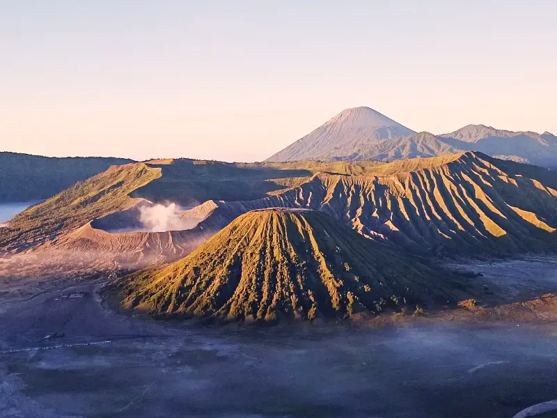
Mount Bromo is an easy day hike to experience in Indonesia. Photo credit: The Curated Travelist
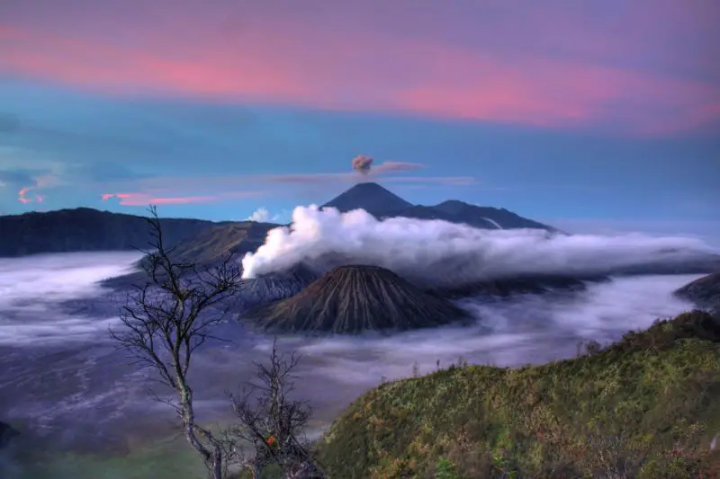
Mount Bromo is considered to be one of the most spectacular day hikes in Indonesia due to its majestic sunrise panoramic and crater rim views.
Apart from the scenic environment, it’s a generously easy hike as you don’t need to climb the full elevation and require minimal climbing or fitness preparation for this adventurous destination.
Sunrise at Mount Bromo is viewed from the vantage of Mount Penanjakan (a neighboring peak a short 4×4 drive from the entrance of Bromo Tengger National Park).
From this viewpoint, one can take the famous scene of sunrise unfolding with Mount Bromo, Mount Semeru, and Mount Batok as the backdrop.
Once you’ve completed embracing the sunrise, you’ll take a 4×4 drive to the Mount Bromo permit post to commence your journey up Bromo.
Starting with a short walk across the “sea of sand” which is an area covered in volcanic ash but not especially deep, then trekking the dune terrain of the slope of Mount Bromo where you’ll then find the carved steps up to the crater summit.
The summit is at an impressive elevation of 2,329 meters (7,641 feet) above sea level.
Peering into the depths of an active volcano is few most travelers can boast of which makes this a must for outdoor and adventure enthusiasts.
As a result of the jaw-dropping views, lack of hiking skills needed, location-friendly access, and affordability it makes for an extremely popular day trip for locals and tourists alike visiting East Java and a must for any traveler looking for more than just Bali and beaches in Indonesia.
How to Get there: The closest major cities are Surabaya and Malang which are easily accessible by flight from Jakarta or Bali.
A tour is highly recommended as travel from the cities as well as accommodation and guides can be arranged before arriving at this popular destination.
Admission Cost: 220,000 IDR ($15.80 USD) for weekdays; 320,000 IDR ($23.00) for weekends if visiting on your own
Check out these Mount Bromo tours:
Bromo Sunrise Tour from Malang
Bromo Private Tour from Surabaya
Ijen and Bromo 3-Days Tour from Bali
Read More: Visit Colorful Houses in Malang
2. Ijen (Kawah Ijen)
Hiked by Martina and Jürgen, PlacesofJuma
Location: East Java
Round Trip Distance: 6 kilometers (3.8 miles)
Duration: Half-day tour; Walking time (without breaks) 3-4 hours round trip
Difficulty: Easy – Moderate
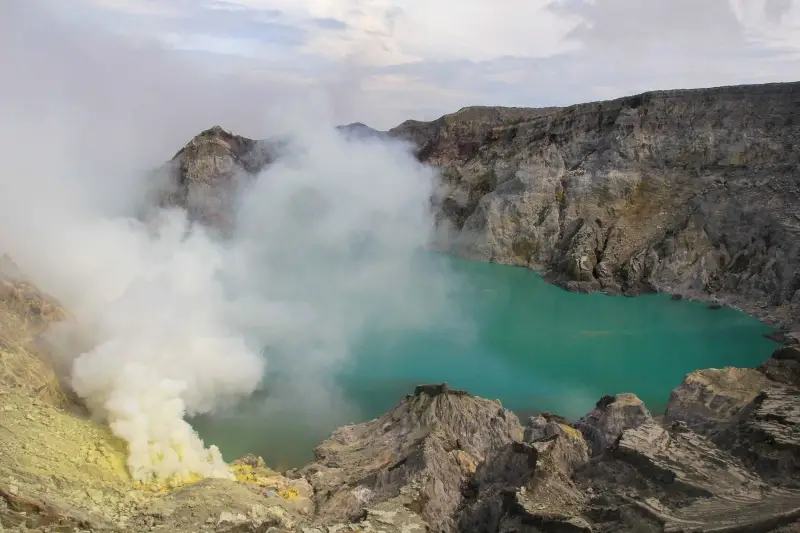
Ijen needs to be on your Indonesia hiking bucket list. Photo credit: PlacesofJuma
Ijen is a volcano with a total diameter of 75 kilometers (46.6 miles). One of the most interesting hikes leads out to the turquoise crater lake Kawah Ijen, which is considered to be the largest acid barrel on earth. Here, sulfur is mined under the most difficult conditions.
In the past, the hike was still considered an insider tip, but today you can book this tour even in the travel agencies of Bali. Nevertheless, the hike is a cool experience that you should put on your travel list when traveling to Java.
The hike starts at the parking lot. Be careful as the temperatures can be very cool. Weatherproof clothing is an advantage here.
A well-maintained path of about 3 kilometers (1.9 miles) in length goes up to the crater. You start the tour along with the sulfur workers. The ascent takes about 90 minutes until you reach the crater.
At the top of the crater, you’ll see fascinating sceneries of the steaming crater lake.
If you dare, and if you can stand the stench of the toxic sulfur, you can hike down to the southeast shore of the lake, one of the most active solfataras on earth and the most significant sulfur accumulation in Indonesia.
But beware as officially it’s forbidden to go down the crater because of the danger. Nevertheless, most tourists go down together with the sulfur workers.
Down there, the sulfur is broken off at the bottom by the miners with iron rods and stowed in the bamboo baskets.
The heavy baskets of the miners, filled with up to 70 kilograms (154 pounds) of sulfur chunks, are then carried down to the valley by the often even lighter workers. It’s unbelievable what conditions the workers are exposed to daily!
Extra tip: Take a hike at night to see the famous Blue Flames and then experience the sunrise at the crater rim.
How to Get There: Taking a taxi or a tour from Banyuwangi. Tours can also be booked from Bali.
Admission Cost: 220,000 IDR ($15.80) for weekdays; 320,000 IDR ($23.00) for weekends if visiting on your own
Book a Mount Ijen tours for easier planning:
Overnight Mount Ijen Tour from Bali
Mount Ijen Sunrise Tour from Bali or Banyuwangi
3-Day Ijen Crater & Mount Bromo Tour from Bali
3. Tumpak Sewu Waterfall
Hiked by Cassie, Cassie the Hag
Location: East Java
Round Trip Distance: Unknown
Duration: 1 hour 20 minutes round trip
Difficulty: Moderate
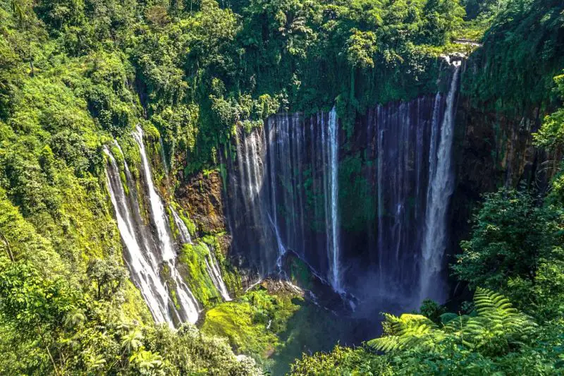
Hiking to Tumpak Sewu Waterfall is a fun adventure to try. Photo credit: Cassie the Hag
One of the amazing and most memorable hikes in Indonesia is Tumpak Sewu Waterfall. Sure, it’s no scenic coastal vista or active volcano, but the trek itself is unique.
While not a long hike, it takes around 40 minutes each way, it has its challenges. Parts of the hike down are made from half-rotten ladders bolted onto the rock face or with ropes where the path is slippery from mini waterfalls disrupting the path. At the bottom, you also have to cross a slow-moving river.
While great for a feeling of adventure, do bear in mind that you’ll need fairly good balance and take some deep breaths if you have a fear of heights. That said, it should be doable for anyone with moderate fitness, and you can always pay a small fee to a local guide if you’re worried.
Tumpak Sewu Waterfall itself is magnificent. It’s truly a real ‘untouched paradise,’ though that may change now visitors to Bali are seeking less saturated adventures in nearby East Java.
To make the most of your day, combine this trip with the hike to Kipas Biwu Falls. This second waterfall is stunning in its own right.
The hike is long but overall less challenging than the first and deserted other than a group of locals swimming in the rock pools below. Overall, it’ll be one of your favorite days in Indonesia without a doubt.
How to Get There: To reach Tumpak Sewu Waterfall, the easiest way is to get a shared car from Malang.
Admission Cost: 20,000 IDR ($1.40)
Book Tumpak Sewu Waterfall Tours:
Click here for a private tour which includes transportation from Malang or Surabaya
Click here for a 3-Day Tour of Mount Bromo, Ijen, and Tumpak Sewu from Surabaya
Read More: Take the Train from Surabaya to Yogyakarta
4. Mount Batur
Hiked by Editors, Jackie and Justin, Life Of Doing
Location: East Bali
Round Trip Distance: Approximately 8.5 kilometers (5.3 miles)
Duration: 3.5+ hours round trip
Difficulty: Easy – Moderate
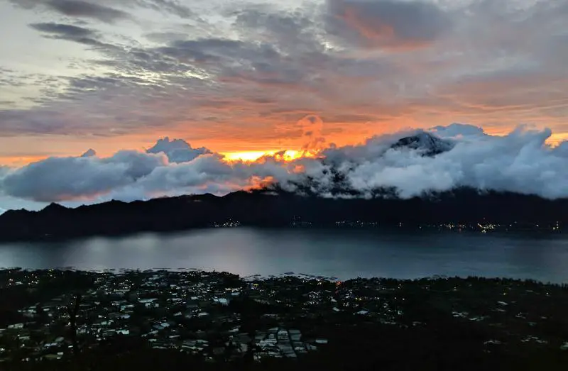
Mount Batur is a popular sunrise hike in Bali to try.
Climbing Mount Batur at sunrise is considered one of the best hikes in Bali to experience. This bucket list hike is located in the northeast part of the island.
Hikers get up super early in the morning to do this day hike up the inactive volcano at 1,717 meters (5,633 feet) high.
The hike is not too difficult and is suitable for beginner hikers.
It starts at 4:00 am and in the dark, so headlamps or flashlights are needed at the beginning of the trail.
The climb on the mountain is a steady hike up a rocky, dirt path along a single track. Take the time to go up the path as some areas are slippery.
At the summit, find a spot to sit and wait for the sunrise. As a heads up, the summit is extremely windy. It’s recommended to wear long pants and to bring a jacket. There is a small cafe at the summit, so warm yourself up with a cup of hot coffee.
If the skies are clear, you’re rewarded with a gorgeous sunrise that overlooks the caldera, Lake Batur, and surrounding towns. Purples, blues, and orange colors light the skies while the vibrant sun peeks through the clouds. Sometimes the sunrise isn’t guaranteed, so it’s a matter of luck.
Once the hike is completed, the tour continues with either a stopover at a local coffee plantation so you can try a variety of coffees and teas or at a hot spring.
Since you completed the hike in the morning, you still have the full day ahead of you to explore Bali.
How to Get there: The easiest way to get to the trailhead is to join a group hiking tour. The Bali hiking tour includes pick-up/drop-off at your accommodation from Ubud, guides, breakfast, water, and/or a side trip to a coffee plantation or hot spring.
The trailhead is about 37 kilometers (23 miles) away from Central Ubud and requires a 1-hour drive one-way.
Admission Cost: While access to the trail is free, expect to pay between 300,000-400,000 IDR ($21-$28) per person for the tour.
Reserve a Mount Batur hike today:
Small Group Mount Batur Sunrise Hike
Private Mount Batur Sunrise Trek with Hidden Waterfall
2 Days Mount Batur Sunset & Sunrise Camping
Read More: Amazing Things to Do in East Bali
5. Campuhan Ridge Walk
Hiked by Brittany, Brittsbellavita
Location: Ubud, Bali
Round Trip Distance: 4 kilometers (2.5 miles)
Duration: 1-2 hours
Difficulty: Beginner
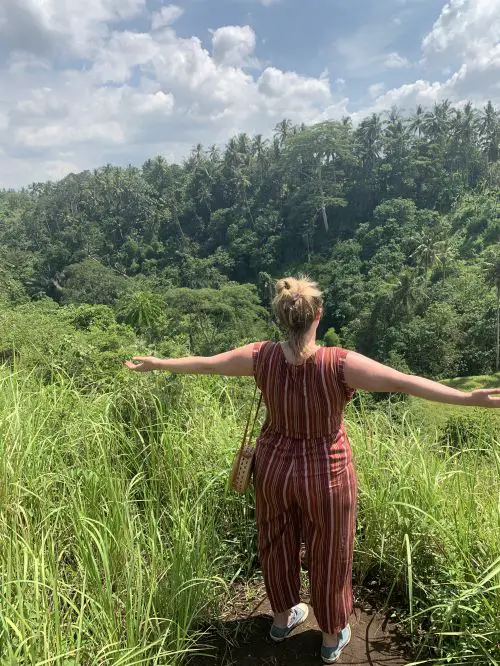
Campuhan Ridge Walk has incredible views and is a must-visit hiking spot in Bali. Photo credit: Brittsbellavita
You can easily access Campuhan Ridge’s out-and-back hiking trail from the Ubud City Center, making this a fun and accessible trail for those looking to enjoy stunning views of Bali’s rice fields and lush greenery without the hassle.
Begin your journey down in the jungle by the beautiful ancient temple called Pura Gunung Lebah before making your way up onto the ridge walk.
As you crest to the top of the ridge you’ll come upon a small village of cafes and art shops.
Grab a refreshing drink to cool off from the hike or shop around for some souvenirs to take home. You’ll find that the prices of art and items are much cheaper in this village than in downtown Ubud.
If you want to enjoy the trail at its most peaceful hours, hike at sunrise or sunset to beat the crowds and the midday heat.
TIP: Make sure to bring water to stay hydrated because it can get quite hot and there is no shade for most of the trail.
On your way out check out the Gunung Lebah Temple and head down the steps to view the Pont de Campuhan bridge and river.
You won’t want to miss out on experiencing the serene and stunning views of the Campuhan Ridge Walk, especially if you’re visiting Bali on a honeymoon.
How to Get There: The easiest way to enter the trail is from Downtown Ubud. Add Warwick Ibah Resort into your Google maps and go down the road with the sign that says, “Going to the Hill.”
As you walk down the road Jl Bangkiang Sidem, the temple is on the left and the trail to the ridge walk is on the right.
Admission Cost: Free
Read More: Incredible Day Trips from Ubud To Not Miss
6. Kelingking Beach
Hiked by Victoria, Guide Your Travel
Location: Nusa Penida
Round Trip Distance: 800 meters (.5 miles)
Duration: 40 minutes to go down, 90 minutes to go back up
Difficulty: Challenging
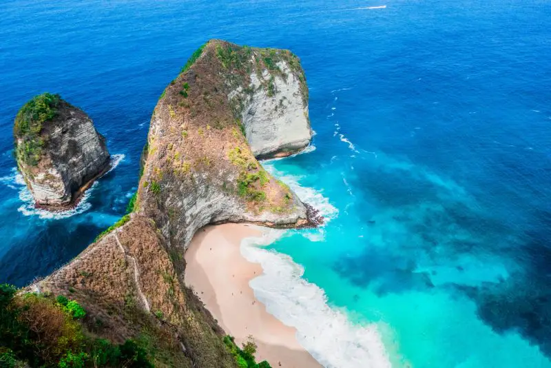
Hiking down Kelingking Beach is challenging, yet rewarding. Photo credit: Guide Your Travel
The hike down to Kelingking Beach might just be one of the most popular things to do on the little island of Nusa Penida. The trail is notorious for being extremely steep and feels more like a climb in some places.
You should only attempt this hike with appropriate footwear and if you have some level of physical fitness.
Since the trail leads you down a 400 meters (1,312 feet) high cliff, the hike down to Kelingking Beach can be incredibly dangerous if you’re not careful. Always hold on to the handrails and let other hikers pass if necessary.
The hike is worth the effort though. You’re rewarded with incredible views and of course the beauty of Kelingking Beach when you reach the bottom.
Refresh yourself with some cold drinks from one of the little beach stalls and keep an eye out for the manta rays that like to gather in the bay.
While swimming is allowed, be careful with the currents as they can be very strong. (Note: Please check the current situation if swimming is allowed.)
Don’t forget that you have to make your way back up again. The way down Kelingking Beach is a lot easier than hiking back up.
Temperatures are usually very hot so you’ll climb up nearly vertically in the scorching sun. Take plenty of breaks and make sure you drink enough water.
How to Get There: It’s easy to get to Nusa Penida from Bali as you take a speed boat ride from Sanur. On the island, hire a driver or rent a motorbike to go to Kelingking Beach.
Editors’ Note: The road to Kelingking Beach is paved, yet very steep. When driving a motorbike on Nusa Penida, please be careful and take your time descending. There are too many motorbike crashes that occur.
Admission Cost: 5,000-10,000 IDR ($.36-$.72) per person and a small fee for motorbike parking
Sign up for a Nusa Penida Tour which includes Kelingking Beach:
2 Day Tour of Nusa Penida & Nusa Lembongan
One Day Tour of West Nusa Penida
Read More: How to Spend 4 Days on Nusa Islands
7. Seganing Waterfall
Hiked by Sean, LivingOutLau
Location: Nusa Penida
Distance: Unknown
Duration: ~30 minutes one-way
Difficulty: Challenging
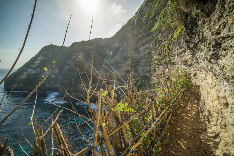
Heading to Seganing Waterfall is a unique hiking trail to experience on Nusa Penida. Photo credit: LivingOutLau
One of the most off-the-beaten-path hikes in Indonesia is the Seganing Waterfall hike. Seganing Waterfall is located on Nusa Penida, 67 kilometers (41 miles) away from Bali.
Though only 30 minutes long, the difficulty of the Seganing Waterfall hike is high.
That is because the trail starts at the top of the cliff and takes you on the edge of the sheer cliffs down to the waterfall.
The only thing that prevents you from your certain death is the man-made bamboo structures made by locals, and they aren’t exactly structural engineers.
Besides getting squished by a possibly unstable bamboo structure and a shear wall, there are parts of the hike where you need to do minor rock climbing. Small indents have been dug into the rock surfaces to allow hikers to hold onto and make their way up and down.
Though adventurous and slightly treacherous, the hike boasts incredible views of the dramatic cliffs and sea of Nusa Penida.
Once you have arrived at the end of the hike, you’ll arrive at a small waterfall and a pool where you can soak as you watch the crashing waves.
Seganing Waterfall is located in the southern part of Nusa Penida, so visitors intending to visit Seganing Waterfall should plan to stay overnight.
There are plenty of amazing places to stay in Nusa Penida, many of which allow you to enjoy the lush scenery that Nusa Penida is known for!
How to Get There: Drive a motorbike or hire a driver to get to the waterfall entrance.
Admission Cost: Free
Read More: Explore Nusa Penida in 2 Days
8. Mount Rinjani
Hiked by Ummi, Ummi Goes Where?
Location: Lombok
Round Trip Distance: 28 kilometers (17.4 miles)
Duration: 2-3 Days
Difficulty: Moderate – Challenging
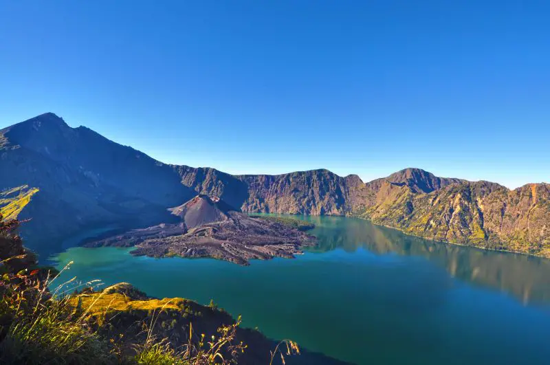
Mount Rinjani is an adventurous hiking spot to trek for a few days. Photo credit: shahreen via Depositphotos.com
At 3,726 meters (12,224 feet) above sea level, Rinjani is the second-highest mountain in Indonesia. It’s an active volcano with its most recent eruption in 2016.
But what Rinjani is most famous for is its massive caldera that contains a beautiful sapphire-blue lake called Segara Anak. This lake is the world’s highest caldera lake with an active volcano in its center.
However, despite its high altitude, the water is not as cold as you might imagine. It averages around 20o Celsius (68o F), which is several degrees warmer than the surrounding temperature.
There are two different routes to climb Mount Rinjani. The Senaru route takes you through the lush tropical rainforest, while the Sembalun Lawang route passes through rolling hills and grasslands.
To get the most out of your trip, you might consider going up one route and down the other.
It takes 7-8 hours to hike to Rinjani crater rim, where you can set up camp overlooking the lake. Most hikers stop here before going back down the next day.
An extra challenge is to continue hiking down to the lake and/or up to the summit. This is where the difficulty level goes from moderate to difficult. Only 25% of Rinjani hikers make it to the top.
Although the trail to the summit isn’t technical, it’s very steep, windy, and the ground is made up of loose volcanic sand.
After your hike, check out these other exciting Lombok attractions to visit on the island.
How to Get There: Fly direct into Lombok from Bali, Jakarta, Surabaya, Singapore, or Kuala Lumpur.
There’s also a ferry service from Bali. Check here to buy speedboat tickets between Bali and Lombok.
If you book a tour, your guide will pick you up from wherever you’re staying in Lombok to Mount Rinjani.
If you’re going independently, you need to either self-drive or hire a driver to take you on the 2.5 to 3-hour journey.
Admission Cost: The entrance fee is 150,000 IDR ($10.70) per person/day. An all-inclusive tour package would cost anywhere from $100-$400, depending on the tour company, duration of the hike, and the number of people in the group.
Check out this Mount Rinjani Tour:
2 Days/1 Night Mount Rinjani Private Trek
9. Padar Island
Hiked by Editors, Jackie and Justin, Life Of Doing
Location: Komodo National Park
Round Trip Distance: 1.6 kilometers (1 mile)
Duration: 30-40 minutes round trip without breaks
Difficulty: Easy – Moderate
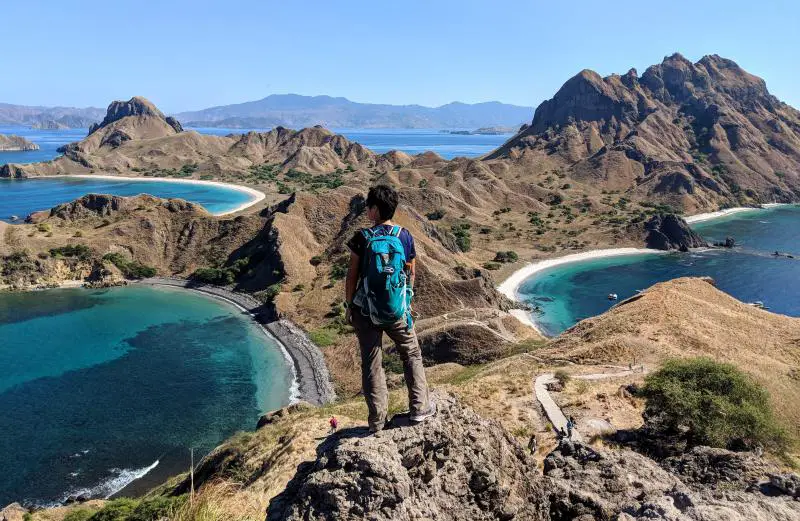
Padar Island is one of the best hikes in Indonesia to see gorgeous views! Photo credit: Life Of Doing
Padar Island is one of the most photogenic places to visit in Indonesia and also has a short hike to conquer.
As one of the stops on a Komodo National Park day trip tour, hiking to the summit of Padar Island provides the iconic panoramic view of three turquoise bays and sandy beaches. You’ll want to capture this postcard-perfect shot!
The out-and-back hiking trail isn’t difficult, so it’s great for beginner hikers.
The first portion of the trail is a wooden staircase. Once you reach the dirt path, follow the most used trail along the dirt path.
Watch out for loose gravel and rocks and you may need to hoist yourself up some rocks. As you get closer to the summit, the path gets a bit steeper.
The summit is approximately 160 meters high (525 feet) so it’s a quick hike up. At the summit, take the time to soak in the beauty and capture the moment. There are a few photo spots where you can get the three bays in the photo.
Remember to bring water as the trail isn’t shaded.
How to Get There: Take a Komodo National Park day tour from Labuan Bajo. Visitors take a speedboat or a wooden boat to the various attractions.
Admission Cost: There isn’t an admission cost when you arrive on Padar Island.
You’ll pay a Komodo National Park fee when you arrive at Rinca or Komodo Islands. The starting cost is 150,000 IDR ($10.70) for weekdays and 225,000 IDR ($16.00) for Sundays and holidays. Extra fees may be applied.
Check out Padar Island with a Komodo Islands tour:
2 Days Komodo National Park Tour
10. Mount Kelimutu
Hiked by Ellie, Ellie’s Travel Tips
Location: Flores Island
Round Trip Distance: 24 kilometers (15 miles)
Duration: 6 hours round trip
Difficulty: Moderate
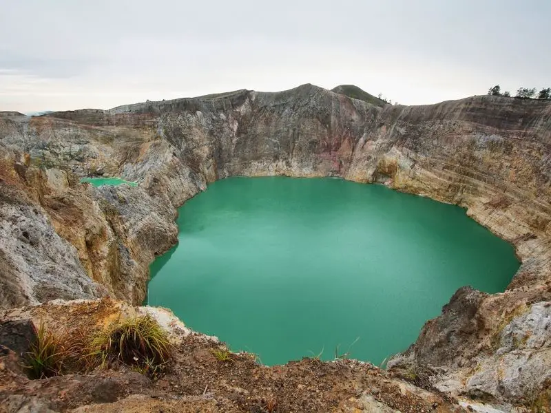
Mount Kelimutu is a fascinating hike in Indonesia to see the colorful lakes. Photo credit: Ellie’s Travel Tips
Mount Kelimutu is world-renowned for the three tri-colored lakes nestled at the top of it. Collectively, the locals refer to these magnificent bodies of water as Kelimutu Lake.
Sitting at over 1,600 meters (5,249 feet), every step along this uphill hike will be worth it.
At the top, you’ll notice these magical, color-changing lakes with a breathtaking, panoramic view of the mountaintop landscape.
The colors of the lakes tend to be a bright blue, but they’re known to range between green, blue, red, and black depending on the season and other natural occurrences.
The actual hiking trail is a simple stairway, perfect for any hiker looking to see these magnificent lakes.
Hiking up Mount Kelimutu at sunrise is the best as you’ll get the chance to take in the enchanting turquoise waters contrasting against the vivid oranges and yellows of the sunrise.
Make sure to wait until the sun shines on the color-changing lakes before you leave to watch them truly transform.
It’s best to visit during Indonesia’s dry season (between May and September), however, it may be more crowded. The entrance gate opens at 4:30 am, so make sure to wake up early and start your Indonesian hike before the other tourists arrive!
How to Get There: Start your hike in the nearby city Moni. From here, follow the path to the Rainbow Café, towards a waterfall, and over a stream. Then, continue through a small village and start to head uphill on the path.
Admission Cost: 150,000 IDR ($10.70) on weekdays; 250,000 IDR ($18.00) on Sundays and public holidays if visiting on your own
11. Mount Api (Gunung Api)
Hiked by De Wet & Jin, Museum of Wander
Location: Banda Islands, Maluku Province
Round Trip Distance: Approximately 3 kilometers (1.9 miles)
Duration: 4 hours round trip
Difficulty: Moderate
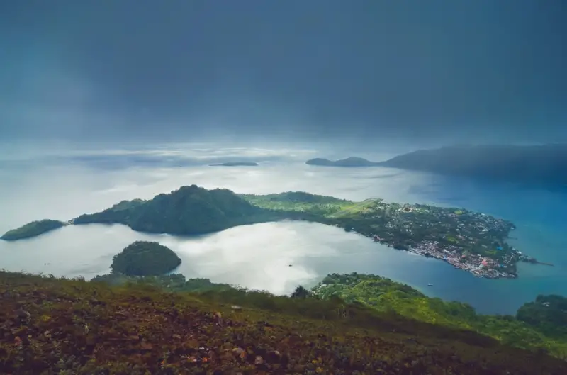
Gunung Api is a highlight when hiking around Banda Islands. Photo credit: Museum of Wander
The Banda Islands, located in Maluku province in eastern Indonesia, are known for having the best snorkeling in the country. At the center of the Banda archipelago, surrounded by incredible coral gardens, is the circular island of Banda Api.
It’s dominated by the active volcano, Mount Api (Gunung Api), which means Fire Mountain. Gunung Api is 640 meters (2,100 feet) high and a half-day hike to the top of the volcano rewards you with a breathtaking view of the whole archipelago.
The island of Banda Api is separated from the island of Banda Neira where a few guesthouses are found, by a few hundred meters of water.
Your guesthouse will help you organize a small boat to take you across the water to the trailhead.
It’s recommended to leave Banda Neira just before sunrise and return for a late lunch and a long nap.
The path leading up to the summit is easy to follow, but the walk is quite intense as it heads straight up the volcano and the angle is quite steep.
The first half of the trek is through lush bamboo, ferns, and forest. About halfway up, the trees stop, and then the path has rocks and gravel to the top.
On the summit, soak in that incredible view and stretch out on the hot gravel that is heated by the volcanic activity underneath.
The last time Gunung Api erupted was in 1988 and you can see three huge gaping craters with lava flows tumbling to the cobalt blue waters below.
How to Get There: Getting to the Banda islands is not always that easy, but it’s one of the most incredible places to visit in Indonesia. To get to the trailhead, your guesthouse can help organize the boat ride.
Admission Cost: Free
12. Baliem Valley
Hiked by Christian, Unusual Traveler
Location: West Papua Province
Round Trip Distance: Varies from 4-14+ kilometers (2.5-8.7+ miles)
Duration: 1-5 Days
Difficulty: Moderate – Challenging
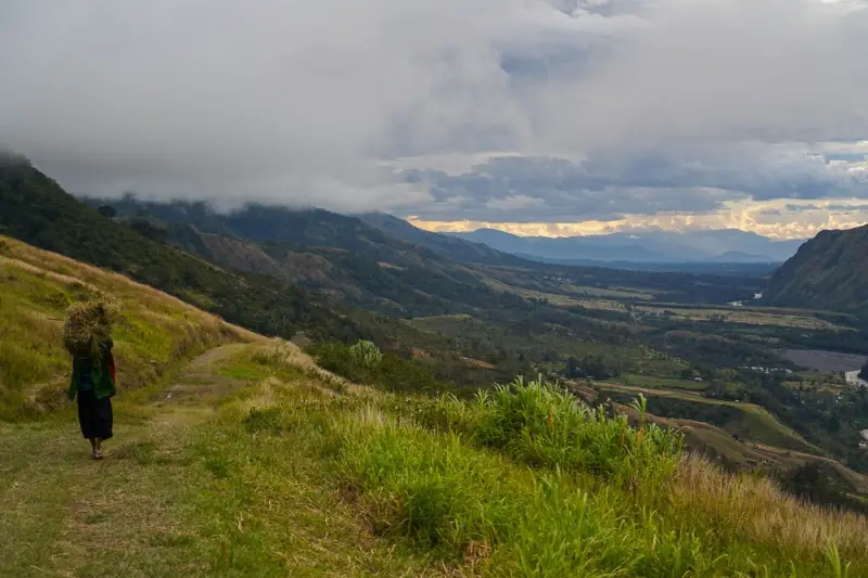
Baliem Valley is an off-the-beaten-path destination to go hiking in Indonesia. Photo credit: Unusual Traveler
In Eastern Indonesia’s West Papua province is a valley where time has been standing still, the Baliem Valley.
It’s the reason most visitors want to visit this part of Indonesia as the valley is named one of the world’s last fascinatingly traditional areas.
You can visit small remote villages and see locals still walking around half-naked and living the traditional way of life.
The Baliem Valley is a hikers’ paradise, but there are a few things you need to know before you decide to go hiking here.
First, you’ll need a permit from the local police office to be allowed to hike and visit everything outside the largest town, Wamena. Some of the hikes start from just outside the edge of Wamena but most hikes will start an hour drive away.
And while you’re allowed to hike independently, it’s highly recommended to hire a local guide. The guide finds the right path around the valley and the surrounding jungle and provides safety. A large part of the valley is home to the Dani tribes which are not always used to foreigners.
You’re required to get a porter to help carry the food needed during the hike. This is useful since there aren’t any restaurants and shops outside the largest town.
Before you decide to visit the valley, decide if you want to do shorter day hikes or if you want to do longer hikes which can last up to two weeks.
The hiking trails don’t have specific names as it’s the names of the villages where you’ll start and finish.
One recommendation is a 5-day hike in the eastern part of the valley from Sogokmo to Sobaahan and back to Sogokmo on the opposite side of the valley.
How to Get There: To get to Baliem Valley, travelers take a small propeller flight from Jayapura, the capital and largest city in the West Papua Province.
Once in Wamena, follow the main road to the end and start the hike from there. There aren’t any signs or markings for the hikes around Baliem Valley, so getting a local guide is often essential to find the trail.
Admission Cost: $70 per day for the guide and porter
Note: The West Papua province in Indonesia is more expensive than the rest of Indonesia so prices for guesthouses, food, and transportation are often double or triple from the rest of the country.
How many of these Indonesian hiking trails are now on your bucket list? We hope you enjoyed this list of incredible hiking and trekking opportunities to experience in Indonesia. Add one or more of these trails to a future Indonesia itinerary.
Enjoy the time outdoors!
Like this post? Save it to your Indonesia Pinterest board.
 |
Featured photo credit: Low Chun Minh via Scopio Photos
Pin #1 photo credit from top to bottom: Jessica May via Scopio Photos; shahreen via Depositphotos.com

6 comments
Incredibly beautiful trails! I recently took up hiking in Kenya, so I feel like I appreciate this post more now!
WooHoo! Glad to hear that you went hiking in Kenya! I don’t know much about Kenya’s hiking trails and would love to hear more about your experiences.
Mt. Bromo and Ijen (Kawah Ijen) seems to be a popular destination as I have read about them before. Mount Rinjani looks beautiful too. I would love to go hiking there someday.
Hi Joydeep. We agree with you! We have these hikes on our bucket list as well. Hope Indonesia reopens to international tourists in 2022 so we can hike up these mountains.
Hi Jackie. Love reading about your travels in Indonesia. As a trekking guide on Mount Rinjani, you are supporting our life. We need more traveler bloggers like you to promote it.
Thank you.
Thanks so much for the kind words! Appreciate your hard work in supporting hikers on Rinjani. We know it’s not an easy hike to do. We look forward to trekking Mount Rinjani in the future.